Things To Do -
HIKING
Let your path lead you to the spectacular
Looking for a way to explore the Montrose area on foot? We've got you covered! With a wide variety array of terrain, landscapes, and experience levels, there's something for everyone.
STROLL IN TOWN
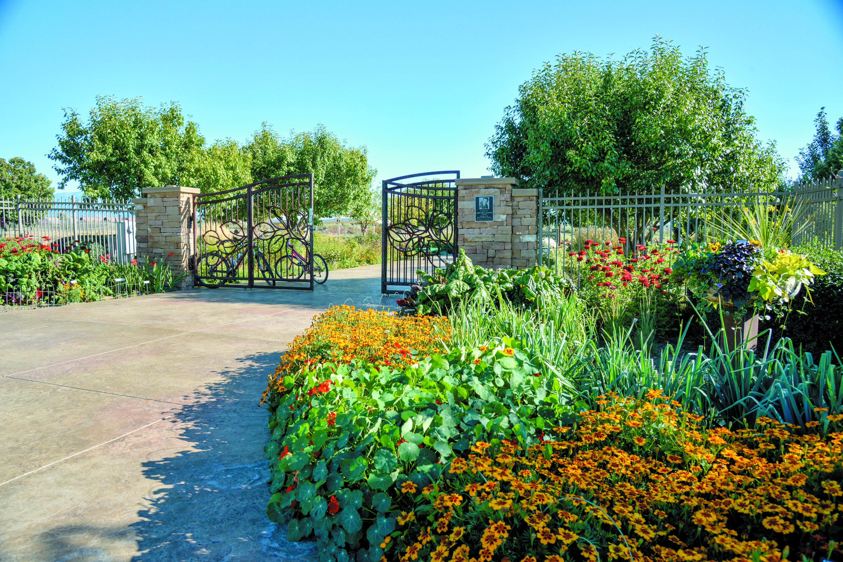 Montrose Botanical Gardens
Easy (paved)
Take a short, delightful walk through these gardens no matter the season. You will find a lovely assortment of flora while gazing at the magnificent San Juan Mountains to the south. This is a perfect place to cap off the day with an after-dinner sunset walk. Adjacent to the Montrose Pavilion and Event Center (1800 Pavilion Dr).
Uncompahgre River Trail
Easy (paved)
The Uncompahgre River Trail is a 14+ mile, lightly traveled trail that follows the river through Montrose. Good for all skill levels in all seasons, the trail is primarily used for hiking, walking, running, and biking. If a canine is your companion, be sure to keep them on a leash and save the off-leash time for the dog park located toward the northern end of the trail. At the Water Sports Park, take the trail spur to the top of Sunset Mesa to, well … enjoy the sunset (or sunrise).
NATURE HIKES IN MORE REMOTE SETTINGS
Black Canyon National Park
Easy to strenuous
Seeing the Black Canyon from convenient overlooks is awe-inspiring, but hikes at the canyon take the experience to a whole new level. There are several magnificent trails in the Black Canyon National Park ranging from easy to extreme. See the Black Canyon article on page 14 for an enticing list of trails within the park or VISITMONTROSE.COM/BCNP
Gunnison Gorge National Conservation Area
Easy to strenuous
Renowned for some of the west’s wildest, most diverse landscapes, the gorge draws visitors to its spectacular geology, challenging white water, and Gold Medal trout fishing. One of the best ways to enjoy the gorge is with a good pair of hiking boots, especially in the Gunnison Gorge Wilderness, which is off-limits to mechanized modes of transportation.
The majestic sandstone canyons, adobe badland formations, and diverse plant populations and ecosystems in the GGNCA naturally give way to primitive winding roads and trails just right for hiking, biking, horseback riding, and motorized sports in designated areas.
There are seven trails of varying length and intensity leading into the wilderness area and along its rim, all of which are accessed via roads recommended for high-clearance, 4WD vehicles.
Ute Trail, one of the most popular and longest wilderness routes, is a 3.5-mile trek (one way) into the gorge with incredible views of the canyon and access to about a mile of Gold Medal water fishing on the Gunnison River.
Bighorn Trail is a 1.5-mile hike (one way) with spectacular views of the river from the rim of the inner gorge and can be hiked as a loop between Duncan and Bobcat trailheads using the Red Rocks-Nighthorse Trail for the return leg. This trail offers solitude for getting in tune with nature.
If you are planning to strike out on a trail in the GGNCA, don’t forget to bring plenty of water and essential wilderness supplies.
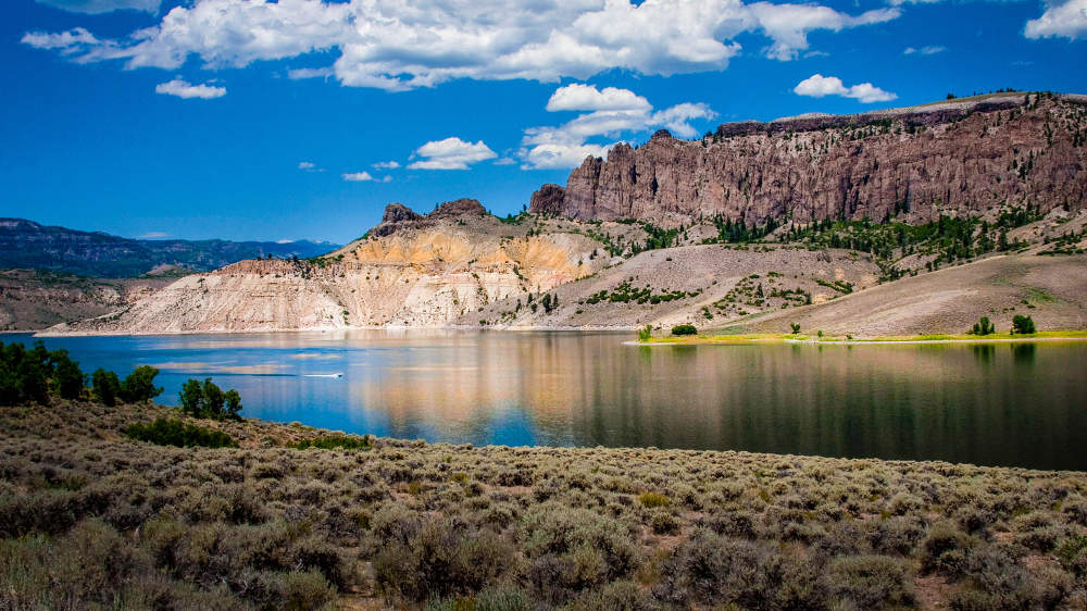 CURECANTI NATIONAL RECREATION AREA
East of town and adjacent to the eastern side of the Black Canyon of the Gunnison National Park is the Curecanti National Recreation Area. Known primarily for fishing and boating delights at Blue Mesa Reservoir, the area also serves up some compelling options for hiking.
Pine Creek Trail
This moderately strenuous, 2-mile trail provides access along the old Denver and Rio Grande Railroad bed leading to the Morrow Point Boat Tour. Despite a couple hundred stairs that lead to the old railroad grade, the hike is packed with opportunities to marvel at the steep canyon walls, snag pics of the crystal clear waters coursing through the canyon, and conjure images of coal-fired locomotives chugging along this long-since-abandoned narrow gauge route. Taking the boat tour is just a bonus to a great hike.
Mesa Creek Trail
Take in the historical narrow gauge railroad displays at Cimarron and follow Cimarron Creek into the narrow, sheer-walled depths of the Black Canyon. The Mesa Creek Trail begins near the parking area and crosses a footbridge over the Gunnison River. An easy to moderate 1.5-mile hike, the trail is a good way to take a break from the road and get a unique perspective of the canyon. Morrow Point Dam, one of three dams on the Gunnison River through the Black Canyon, is visible from the parking area, providing another point of interest on the excursion.
OURAY
Take your hike to a higher elevation and combine the experience with a day in the quaint mountain town of Ouray, located about 35 miles south of Montrose. Made famous by the towering peaks that frame the town, its fascinating mining heritage, the Million Dollar Highway, natural hot springs, and an abundance of scenic wonders, Ouray also invites visitors to explore on two feet.
Perimeter Trail
As the name implies, the Perimeter Trail makes a 4.4-mile loop around the town and through some of the community’s highlights like Cascade Falls, Box Canyon Falls, and the Baby Bathtubs, to name a few. Often enjoyed in shorter sections, popular access points originate from the Amphitheatre Campground, Box Canyon Falls, and the Ouray Visitor Center. Please note that some sections of the trail include steep drop-offs adjacent to the trail, making them questionable for groups
with children.


